

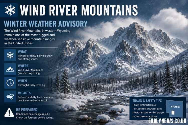
Wind River Mountains Winter Weather Advisory: The Wind River Mountains in western Wyoming remain one of the most rugged and weather-sensitive mountain ranges in the United States. In 2026, travelers, hikers, snowmobilers, skiers, ranchers, and local residents continue to face frequent Winter Weather Advisories due to intense snowfall, dangerous wind chills, and rapidly changing mountain conditions. From Pinedale and Dubois to South Pass and Togwotee Pass, weather can shift from calm skies to whiteout conditions within minutes.
Understanding a Wind River Mountains Winter Weather Advisory is critical before entering the region during the cold season. Whether you’re driving across WY-28, planning a backcountry trip, or monitoring livestock operations, this guide covers everything you need to know for winter 2026.
What Is a Winter Weather Advisory in the Wind River Mountains?
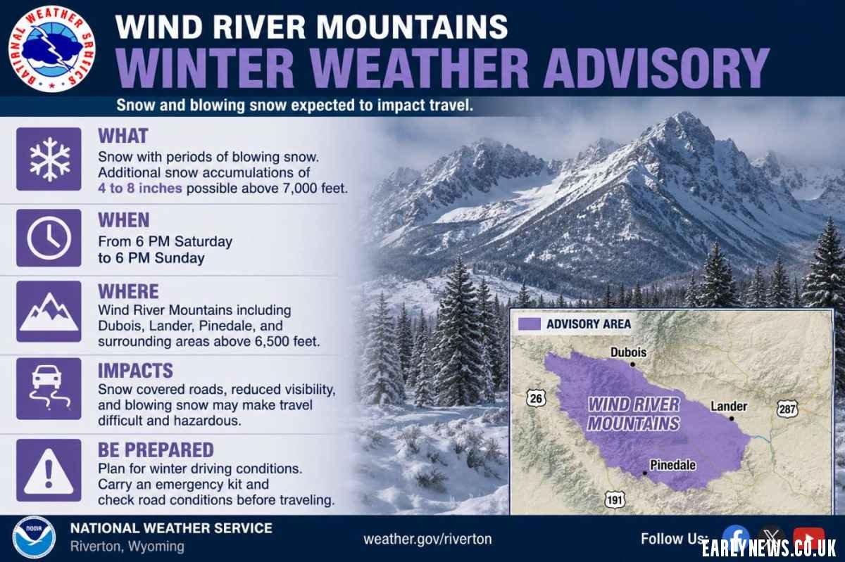
A Winter Weather Advisory is issued by the National Weather Service (NWS) Riverton WY when winter conditions are expected to create hazardous travel and outdoor risks, even if the storm does not meet full blizzard or winter storm warning criteria.
2026 Advisory Criteria for the Wind River Region
The most common triggers for advisories in 2026 include:
- Snow accumulations of 3–6 inches in 12 hours
- 5+ inches in 24 hours
- Blowing snow reducing visibility below 1/2 mile
- Wind chills between -20°F and -39°F
- Light ice accumulation causing slick roads
- Sudden snow squalls near mountain passes
In the Wind River Range, even a “moderate” advisory can become dangerous because of elevation, isolation, and severe wind exposure.
Why the Wind River Mountains Receive Frequent Advisories in 2026
Elevation and Orographic Snowfall
The Wind River Range includes some of the highest peaks in the Rockies, including Gannett Peak at 13,804 feet. Moist Pacific storm systems rise over the mountains and cool rapidly, creating heavy snowfall through a process called orographic lift.
Meteorologists expect the 2026 La Niña weather pattern to increase northwestern storm flow, resulting in repeated snow events from November through March.
Extreme Wyoming Winds
Wyoming’s wind is legendary, and the Wind River Basin often experiences gusts between 50–70 mph. Even when snowfall totals are light, these winds create dangerous ground blizzards and whiteout conditions.
Areas especially vulnerable include:
- South Pass
- Togwotee Pass
- US-287
- WY-28
- US-191 near Pinedale
Long High-Elevation Winter Season
Unlike lower-elevation regions, winter conditions in the Wind Rivers can begin in late September and continue into early June. High-country trails above 10,000 feet may remain snow-covered well into summer.
Wind River Mountains 2026 Advisory Impacts by Area
| Area | Elevation | Main Hazards | Key Roads |
|---|---|---|---|
| South Pass | 7,412 ft | Blowing snow, black ice, 80+ mph gusts | WY-28, US-287 |
| Pinedale & Fremont Lake | 7,175 ft | Heavy snow, severe wind chill | US-191 |
| Dubois / Togwotee Pass | 9,658 ft | Avalanche danger, deep snow | US-26/287 |
| Lander & Sinks Canyon | 5,357 ft | Valley snow, foothill winds | WY-789 |
| High Country 10,000+ ft | 10,000–13,000 ft | Whiteouts, extreme cold | No maintained roads |
2026 WYDOT Updates
The Wyoming Department of Transportation (WYDOT) now uses enhanced real-time wind sensors and variable speed systems along key mountain corridors. Drivers crossing South Pass or Togwotee Pass may encounter automated speed reductions during active advisories.
How to Read a Wind River Winter Weather Advisory
When the National Weather Service Riverton releases an advisory, pay close attention to four critical sections.
Timeframe
Most advisories last 12–36 hours. Conditions can worsen quickly before improving.
Example:
“Winter Weather Advisory in effect from 11 PM tonight until 5 PM Thursday.”
Snowfall Totals
Forecasts often include ranges because snowfall changes dramatically with elevation.
Example:
“Snow accumulations 4 to 8 inches, locally higher above 9,000 feet.”
Wind Speeds
Wind often creates the most dangerous conditions.
Example:
“West winds 30–40 mph with gusts to 60 mph.”
Expected Impacts
Impact statements are extremely important.
Example:
“Travel could become difficult over mountain passes. Visibility below one-quarter mile possible.”
Safety Tips During a Wind River Mountains Advisory
For Drivers
Driving in the Wind River Mountains during winter requires preparation.
Essential safety steps:
- Check WYDOT 511 before departure
- Carry emergency supplies
- Avoid cruise control on snow or ice
- Keep fuel tanks above half full
- Carry chains or winter-rated tires
Winter survival kits should include:
- Blankets or sleeping bags
- Food and water
- Flashlights
- Jumper cables
- Portable battery packs
- Ice scraper and shovel
For Hikers and Backcountry Travelers
The Wind River backcountry becomes extremely dangerous during advisories.
Critical Backcountry Advice
- Avoid ridgelines during high winds
- Monitor avalanche forecasts from BTAC.org
- Carry GPS plus physical maps
- Inform someone of your route
- Turn around early if visibility drops
Wind chills near -25°F can cause frostbite on exposed skin in under 30 minutes.
For Residents and Ranchers
Rural Wyoming residents face unique winter challenges.
Important 2026 concerns include:
- Snow drifting over fences
- Livestock exposure
- Power outages
- Frozen water systems
- Roof stress from heavy snowpack
The 2026 snowpack is projected at 110% of normal in portions of western Wyoming, increasing concerns about structural snow loads.
Best Forecast Tools for Tracking Wind River Advisories in 2026
Reliable weather tracking tools are essential in mountain environments.
Top Weather Resources
| Tool | Purpose |
|---|---|
| NWS Riverton | Official advisories and warnings |
| WYDOT 511 | Road closures and cameras |
| Windy.com | Wind and snow visualization |
| Mountain-Forecast.com | Peak-specific forecasts |
| NOAA Weather Radio | Emergency weather updates |
2026 Technology Upgrades
The National Weather Service now issues more frequent Snow Squall Warnings for sudden whiteout events. Wireless Emergency Alerts (WEA) can send these warnings directly to smartphones.
Winter Weather Advisory vs Warning: Key 2026 Differences
| Alert Type | Meaning | Recommended Action |
|---|---|---|
| Winter Weather Advisory | Hazardous but manageable | Delay travel, use caution |
| Winter Storm Watch | Dangerous weather possible | Prepare supplies |
| Winter Storm Warning | Severe winter conditions expected | Avoid unnecessary travel |
| Blizzard Warning | Life-threatening whiteouts | Shelter immediately |
In the Wind Rivers, even a lower-level advisory can feel like a full warning because of exposure and isolation.
Climate Trends and the Future of Wind River Winter Weather
Climate data from the University of Wyoming shows winter weather in the region becoming more variable. While some valleys experience warmer temperatures, higher elevations continue seeing significant snowfall increases due to moisture-rich storm systems.
Key 2026 Climate Trends
- Higher snow totals above 9,000 ft
- More rain-snow transitions in valleys
- Increased snow squall frequency
- Faster snowmelt at lower elevations
- Stronger wind-driven weather events
Meteorologists predict 10–15 Winter Weather Advisories for the Wind River Mountains East zone during the 2026 winter season, above the historical average.
Final Thoughts
A Wind River Mountains Winter Weather Advisory should never be ignored. Wyoming’s combination of elevation, wind, remoteness, and rapidly changing conditions can turn routine travel into a dangerous situation fast.
Whether you’re crossing South Pass, skiing near Togwotee Pass, hiking the backcountry, or living in western Wyoming, preparation matters. Monitor NWS Riverton, check WYDOT 511, and respect mountain weather forecasts.
The mountains will always be there after the storm clears — the safest decision is often to wait it out.